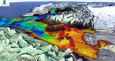
I have been playing some more with google earth. My work at the Norwegian Hydrographic Service makes me a privileged person: this is as close as I can get to my childhood dream of becoming an astronaut (apart from diving of course). Modern technology makes it possible to make amazingly detailed images of the seafloor. Here is an example of Kongsfjorden, Spitsbergen. If you want play around with it yourself you can download the KML here. (tip: switch off "Water surface", you can find it under "View").


